Airspace
Advertisement
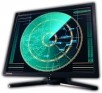
Radar Screensaver
Radar Screensaver will be a fabulous radar on your PC. It will show what happens in its controlled airspace area. You will see not only rotating beam and object blips. There will be object markers with course and speed information, satellite-powered
Advertisement
Flight Wizard v.5 1
Flight Wizard is an easy to use, accurate and inexpensive VFR and IFR (Canada low-level airspace) flight planning software.
Guns of Icarus v.1.0
In an apocalyptic steam punk future, you are a privateer ferrying goods across treacherous airspace.
Vroute.info v.1.0.7.5
vroute.info 1.0.7.5 is an online flight planning tool used for flight simulation and gathering of data. This tool features standard, fixed-size maps with online traffic which can be used to calculate fuel.
Vroute.info premium v.2.0.7.7
vroute.info premium 2.0.7.6 is an online flight planning tool used for flight simulation and gathering of data. This tool features a full screen map for high resolution computer screens.
Jeppesen Internet Flight Planner v.1.0.4
Built on the strength of PC-based FliteStar and AOPA Real Time Flight Planner (RTFP), JIFP is a small application that is downloaded to your PC.
Golden Eagle FlightPrep v.5.1.10040
Golden Eagle FlightPrep was developed to better take advantage of the latest internet online flight planning capability.
EasyPlan3 v.3.0
This software developed for desktop/laptop PC is a must have for all pilots.
GoldenEagle v.6 2
Golden Eagle FlightPrepTM was developed to better take advantage of the latest internet online flight planning capability while retaining all the functionality of the original CirrusTM software.
PocketFMS v.1.5.022
PocketFMS is a Flight Planner & GPS Moving Map software package that makes flight planning a breeze: plotting your route, incorporating weather information, computing performance, weight & balance and fuel consumption, suggesting alternates; PocketFM
NotamView v.1.0.1
NotamView is a tool that displays a UK NOTAM in a graphical format on a map. It is primarily aimed at glider pilots with the ability to place a task planned around BGA turnpoints on the same map and look for potential conflicts.